
Millcreek ZIP Code Coverage
Official Utah health mapping associates Millcreek with 84106, 84151, and 84109, while the same material assigns 84117 and 84124 to Holladay and 84121 to Cottonwood. Millcreek event materials also show 84106, 84109, 84117, and 84124 addresses. The records point to an edge condition, not a mistake. Postal city names describe delivery geography. City limits come from municipal and county boundary records.
| ZIP | Areas or post office label | Millcreek note | Check |
|---|---|---|---|
| 84106 | Salt Lake City mailing area | Core western and central Millcreek use | Parcel for city line |
| 84109 | Salt Lake City mailing area | Millcreek and adjacent Salt Lake City | USPS and GIS |
| 84151 | Special Salt Lake City postal designation | Listed for Millcreek in Utah material | USPS address result |
| 84117 | Holladay mailing area | May serve eastern or southern Millcreek | Parcel boundary |
| 84124 | Holladay mailing area | Foothill and eastern edge confusion | Parcel boundary |
| 84121 | Cottonwood mailing area | Possible edge confusion | Do not assume Millcreek |
No official unique or PO-box-only ZIP serving the city, and no verified ZIP split or realignment year, was located. The table is a practical set of ZIPs surfaced by official Utah sources, not a claim that every address in a ZIP sits inside Millcreek.
Millcreek ZIP Search Clues
A ZIP code directory search for 84106 or 84109 can begin with a name, address, or postal line, but the final link should be a parcel. Search the Salt Lake County Assessor by address or owner and open the parcel detail. The site's physical or situs address is where the land sits. The owner mailing address may use a different city or ZIP and may be outside Millcreek.
For a family-history query, the ZIP is a useful filter in newspaper, unclaimed-property, or voter-file material, but not a complete resident roll. Current voter status is a self-oriented form. A full voter file includes residential address, county, precinct, and district, but is fee-based and subject to public, private, and At-Risk classifications. Do not infer that a Salt Lake City postal label changes a Millcreek legal address.
Holladay ZIPs in Millcreek
ZIP codes 84117 and 84124 can carry Holladay as the postal city while serving parts of Millcreek's eastern or foothill geography. Millcreek runs from the Jordan River to Millcreek Canyon and borders Salt Lake City, Murray, and Holladay. The city formed in 2016 from an older unincorporated township, so postal labels, neighborhood names, and record custodians were not rebuilt at the same time.
Use the city maps hub, county GIS, and Assessor parcel detail for jurisdiction questions. The Millcreek maps hub can orient boundaries and historic parcels, while the county viewer supplies parcel selection and owner detail. A ZIP field should be treated as a mailing clue, not as a legal boundary.
Millcreek 84151 ZIP Check
Utah health mapping lists 84151 for Millcreek, but the research did not capture an address-by-address USPS result or enough evidence to define its delivery use. Treat it as a flagged ZIP, not as a promise that every 84151 address belongs to the city. No specific ZIP code split, special institution, or PO-box-only use was verified.
When a ZIP code directory result matters, save the complete street address and the USPS result date. Then compare the address with the Assessor's situs, parcel ID, and city boundary. The Recorder's legal description is the final property key when a street or postal label is unclear.
Millcreek USPS ZIP Standardization
The USPS ZIP Lookup Tool accepts a residential or business street address, city, and state and returns a standardized ZIP. USPS cautions that its response does not guarantee the address is the actual business location. Use it to check a delivery line, then use county records to check land and jurisdiction.
- Enter the full street address, city, and Utah.
- Save the returned ZIP and standardized street format.
- Search the Assessor using the physical address or owner.
- Open GIS and compare the selected parcel with the Millcreek boundary.
- Use the Recorder legal description if the address and ZIP still conflict.
This approach prevents a ZIP code directory from becoming a postal-city directory by mistake. It also preserves the difference between delivery address, tax mailing address, and situs.
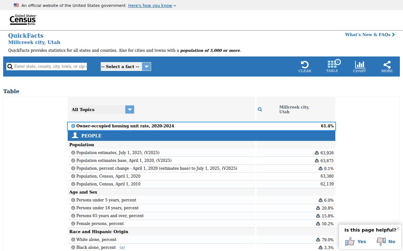
The Census QuickFacts Millcreek record provides a city-level geographic reference for population, land area, and density.
Millcreek Portals and ZIP
ZIP fields do not behave alike. The Assessor accepts address and parcel searches, but the official form does not document a ZIP filter. The Parcel Viewer queries parcel number, owner, property type, and tax district; its exact ZIP behavior was not located. Vote.Utah.gov accepts ZIP in the self-status form. A statewide voter file includes full residential address and districts, but costs $1,050 once, while an election file costs $35 per election and excludes private registration.
| USPS | Street, city, state, delivery ZIP |
|---|---|
| Assessor | Owner, address, parcel, frontage, street, direction |
| GIS | Parcel, owner, property type, tax district, map selection |
| Voter status | Name, DOB, street, city, ZIP for a self check |
| Full voter file | Residential address, county, precinct, district, voting fields, with protected voters anonymized |
A ZIP code directory should never promise a ZIP-wide list from a portal that does not document that function. Narrow by ZIP in the source that supports it, then move to an address-level record.
Millcreek ZIP Address Keys
Four address keys often appear in the same search. ZIP identifies a delivery area. Situs identifies the physical parcel. Mailing address tells the Assessor or tax office where owner correspondence goes. A legal description identifies the recorded land through a subdivision, lot, block, or metes-and-bounds description. These keys can point to different cities and ZIP codes.
- ZIP code
- A postal delivery code, not a municipal boundary.
- ZIP+4
- A more precise postal extension; no Millcreek-specific ZIP+4 inventory was located.
- PO-box ZIP
- A postal designation for a box location; no city-specific one was verified.
- Carrier route
- A delivery grouping, not a land parcel or resident roll.
The county Assessor and GIS key on parcel and situs. The Recorder keys on grantor, grantee, document, and legal description. Directories use printed street addresses. USPS keys on delivery. Keeping the terms separate is the main safeguard when a ZIP code directory search crosses Salt Lake City, Holladay, or Cottonwood labels.
Millcreek City and ZIP Labels
Incorporation on December 28, 2016 created a new Millcreek city label over records that had used county and neighborhood names for generations. East Mill Creek, Canyon Rim, Mount Olympus, Millcreek Township, and Millcreek CDP can appear in older directories, maps, tax records, or news. The 2020 “Unincorporated Triangle” annexation record is another reminder to date boundary work.
For street-level follow-up, use the Millcreek by-street search after a ZIP narrows the area. For old households, use directory and deed sources under the historic label that matches the year. A ZIP code directory is most useful when it hands the reader to the correct next key.
A ZIP code directory becomes more useful when each result keeps the complete address, date, source, and jurisdiction together. USPS answers delivery, the Assessor answers parcel ownership, the Recorder answers recorded land interests, and city or county boundary data answers where Millcreek applies. If the postal line remains uncertain, ask the relevant office rather than assigning a city from the ZIP alone.
For a ZIP-based family or civic search, retain both the postal result and the county result. The ZIP code can help locate a newspaper notice or a voter-file record, while the parcel and legal description provide the steadier land key. If an address falls on the edge of Millcreek, Salt Lake City, Holladay, or Cottonwood, date the boundary source as carefully as the person record.
The most reliable ZIP workflow keeps three dates together: the date the address was standardized, the date the parcel was checked, and the date the person record was viewed. A postal answer can change when a carrier route or delivery line changes. A county parcel can keep the same legal description while an owner mailing address changes. A voter status page can reflect the voter's own current check, while a paid statewide file has its own release and fee rules. Those dates prevent a ZIP code directory result from looking more current or complete than it is.
For 84106 and 84109, compare the USPS response with the Assessor's physical address and the county GIS boundary. For 84117 and 84124, pay special attention to the Holladay postal label and the parcel's city or tax district. For 84151, preserve the Utah health-mapping reference as a flagged source because the research did not capture an address-by-address USPS result. For 84121, check the Cottonwood label rather than assuming that a search result belongs to Millcreek. The point of the table is to identify the next check, not to make a ZIP-wide resident list.
A ZIP search can also help a historical inquiry without deciding it. Search a newspaper, directory, or public notice by the ZIP and then copy the complete street address from the hit. Older material may instead say East Mill Creek, Canyon Rim, Mount Olympus, Holladay, or Salt Lake County. Pair the historical label with the county parcel and the publication year. The city's 2016 incorporation and the 2020 Unincorporated Triangle annexation are reasons to date boundary conclusions instead of silently applying today's city name to every older record.